Why are Warrnambool councillors approving a new build in a flood zone?
Despite objections from the local catchment management authority, the council voted to approve a floodplain development, arguing the latest study was never officially adopted.
Zara Cuthbertson
August 06, 2025
Warrnambool councillors have doubled down on their rejection of state-backed flood study plans for the city’s south, unanimously approving a planning permit that would allow a house to be built directly in the path of potential future flooding.
Two months ago, councillors voted 4-1 to reject recommendations from an independent and peer-reviewed flood study for South Warrnambool and Dennington, with some questioning the “supposed science” of the data.
Council CEO Andrew Mason told the Brolga in June that council officers were still “unpacking the implications” of the rejection and figuring out a way forward with the Glenelg Hopkins Catchment Management Authority (GHCMA) and the Department of Transport and Planning.
The council’s decision to reject the flood study made headlines, with the study’s principal environmental engineer and lead investigator Michael South telling the ABC the findings placed the area on the “upper end” of flood risk.
South said that after working on about 20 flood studies, using “consistent methodologies”, the push-back from Warrnambool councillors was “a first”.
“This is the highest resistance I've experienced,” he said.
In rejecting the initial study, councillors said they did not trust the data, claiming it was difficult to understand and that parts of the study were based on “assumptions”.
Councillors also voiced their disapproval of potential decreases in property values and increased insurance premiums if the recommendations were approved.
Councillor Vicki Jellie questioned “how can anyone have the insight” to “make a decision now for the next 75 years” in response to the investigation.
“The loss of land value that has already come to pass, I find that very [concerning],” Councillor Debbie Arnott said.

How did this latest planning permit get approved?
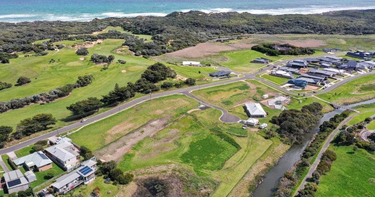
At Monday night’s council meeting, CEO Mason put forward a recommendation to refuse a planning application at Oceanex Close in south Warrnambool after the GHCMA objected to the issue of a permit.
The development site is located within land subject to inundation overlay, which triggered the need for a planning permit.
This type of overlay is applied to land that’s known to be at risk of flooding, and it ensures that proposed developments are assessed before going ahead. In these cases, the GHCMA is consulted as a recommending authority.
In its objection, the GHCMA argued the development would reduce flood storage by adding fill to the floodplain, and noted the site lacked safe access in the event of a flood.
Upon hearing the recommendation, Councillor Vicki Jellie put forward an alternate motion - a proposed change to the original recommendation - to dismiss the GHCMA’s objection and approve the planning permit.
What did councillors say?
Councillor Jellie said applications for planning permits in the Oceanex Close area should have used the “previous study information and data” from the 2007 flood study information currently used by council.
“The Glenelg Hopkins Catchment Management Authority have made their recommendation on that data from the 2024 study investigation, which was clearly not ratified by Warrnambool City Council,” she said.
Councillor Matt Walsh pointed out that although he believed the subdivision “should never have proceeded in the first place”, council had an “obligation to the landowners” to allow the build to go ahead.
But Walsh also ventured that the flood investigation of the area “will, in the future, need to be looked at again”.
“The 2007 study is no longer accurate. The predicted flood levels will be closer to the 2014 mapping than they will be to the 2007 level. Climate change is having an impact and will continue to do so,” he said.
What did the study find?
Using expert consultants, the 2024 study used climate projections to the year 2100 that included a 1.2-metre sea level rise and 41 percent increased rainfall intensity.
This data was expected to significantly raise flood levels in local waterways, with average annual flood damages estimated at over $700,000.
A warming climate = more intense rainfall events
According to data from Victoria’s Climate Science Report 2024, average annual rainfall is down, but extreme rainfall events are becoming more intense, having almost doubled since 1958 to 1985.
The report noted “high-impact climate hazards that affect Victoria”, including floods, are also changing and are projected to “exacerbate under a warming climate”.
“If greenhouse gas emissions continue to rise at a moderate to high rate, flood risk in Victoria is likely to double by the end of the century,” the report read.
Only two months ago, the Brolga reported on a waterfront restaurant in Warrnambool closing after “highly problematic” ocean conditions caused the mouth of the Hopkins River to close, resulting in a flood that put the restaurant in the danger zone.
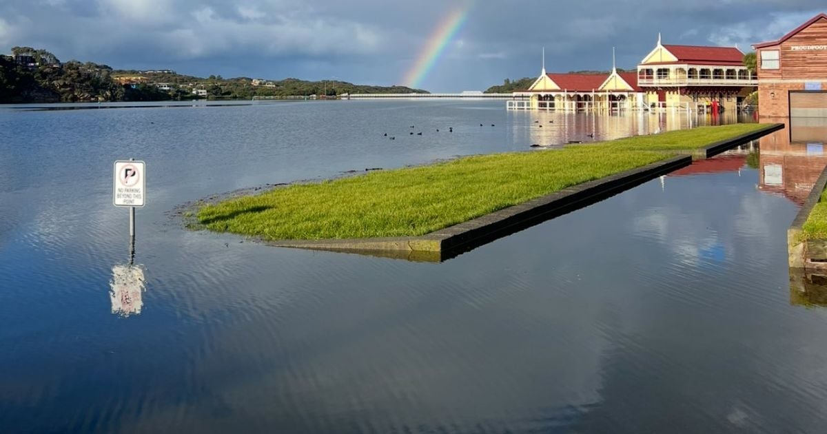
In October 2020, roads were closed, farms were “inundated” and properties were threatened across Warrnambool and Port Fairy after what the ABC described as the “worst flood event in the region in a decade”.
The report from the ABC noted the area saw its October rainfall average in “two days”, with 56mm of rain falling in a three-hour period over the evening of October 8.